When Mount Mazama in southern Oregon erupted almost 7700 years ago, the volcano lost almost a mile of elevation and collapsed into a broad caldera. The caldera eventually filled with water and became Crater Lake.
Born from the fire of eruption, Crater Lake has been an attraction and inspiration to people for thousands of years. As a 16 year old boy in Kansas, William Gladstone Steel learned about Crater Lake by reading a newspaper used to wrap his lunch. The lake became a lifetime obsession. Two years later Steel moved to Oregon and in 1885 he joined a group headed for Crater Lake. Upon seeing the deep blue of the lake Steel exclaimed "All ingenuity of nature seems to have been exerted to the fullest capacity to build a grand awe-inspiring temple the likes of which the world has never seen before." Steel's dream was to make Crater Lake a national park. His dream was realized on May 22, 1902 when President Theodore Roosevelt signed the bill giving the lake national park status.
Crater Lake is 1,943 (592 meters) feet deep, making it the deepest lake in the United States and the ninth deepest on earth. Its deep pure blue waters, two thousand foot cliffs and two picturesque islands make it a place of immeasurable beauty; like nothing else on earth.
Crater Lake Lodge was built in 1915 to provide overnight accommodation for visitors to Crater Lake. The lodge is located on the southwest rim, 1,000 feet above Crater Lake. In 1967, the National Park Service acquired the Crater Lake Lodge and it was placed on the National Register of Historic Places in 1981. The building continued to deteriorate due to the harsh environment and lack of funds for maintenance. Despite being listed on the National Register of Historic Places, the National Park Service scheduled the building to be demolished. The decision was later reversed due to public opposition. In 1988, the National Park Service approved a plan to rebuild the lodge as part of a comprehensive effort to redevelop the entire Rim Village.
An eruption occurred 70,000 years ago and formed the pink, buff and orange Pumice Castle formation on what is now the east side of Crater Lake. Subsequently it was buried by the Redcloud Cliff flow and then exposed when Mount Mazama erupted and its caldera collapsed. Rain and wind have since finished the job of carving the pumice into its hoodoo shaped formations. Pumice Castle sits about 1,300 feet above the surface of Crater Lake.
The Pinnacles are towering needle-like formations of rock, called fossil fumaroles, that project from the bottom of Sand Creek Canyon. They were formed under sheets of volcanic pumice that preceded the collapse of Mount Mazama. As the surface of the hot pumice cooled, steam and gases were released through vents and tubes. The tubes were welded into cement hardness by the passage of the gases. Erosion later removed most of the softer surrounding ash and pumice, leaving the tall pinnacles and spires. The Pinnacles are southeast of Crater Lake.
The Watchman Lookout Station is located on Watchman Peak, at 8,025 feet above sea level above the western shore of Crater Lake. The building was constructed in 1932, and served as fire lookout and museum. The National Park Service had trained observers staffing the lookout during the fire season until 1974. Since then it has only been staffed intermittently. Because of its accessibility, view and use of native materials the Watchman Lookout Station was listed on the National Register of Historic Places in 1988. The Watchman Lookout is accessed from West Rim Drive.
The Pumice Desert is a conspicuous natural feature near Crater Lake. Prior to the eruption of Mount Mazama over 7,700 years ago, the Pumice Desert was a deep glacial valley. The valley was buried by pumice ejected during the eruptions and subsequent avalanches of pumice and scoria deposits. These deposits may exceed 200 feet in depth, hindering plant growth and contributing to the desert-like landscape. Even after thousands of years, few trees have become established on the Pumice Desert. This is in sharp contrast to the surrounding lodgepole pine forests. Ample water exists under the surface but deficiencies in the soil inhibit plant growth. Pumice Desert is about 6 miles north of Crater Lake on the Volcanic Legacy Scenic Byway.
Garfield Peak, at 7,976 feet above sea level, is a prominent peak at the south end of Crater Lake near the Crater Lake Lodge. Garfield Peak was named for James Rudolph Garfield, the Secretary of the Interior for President Theodore Roosevelt who, in 1902, signed the bill creating the national park. Garfield was the son of President James Garfield.
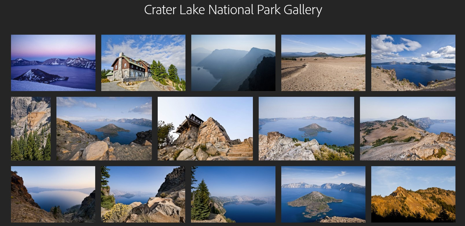
This gallery contains some of my favorite Crater Lake National Park images that are available as downloads and fine art prints. To view the gallery, click here or on the photo collage above. When you are in the gallery, click on a thumbnail to enlarge an image. To navigate the images click on the arrows. To see the captions click on the (i) symbol.